Day 068: Countisbury to Minehead
Distance: 19.45 miles
Ascent: 7970 feet
Weather: Showers Morning, Sunny Spells Afternoon
Accommodation: AirBnB Minehead, Courtesy of Sarg
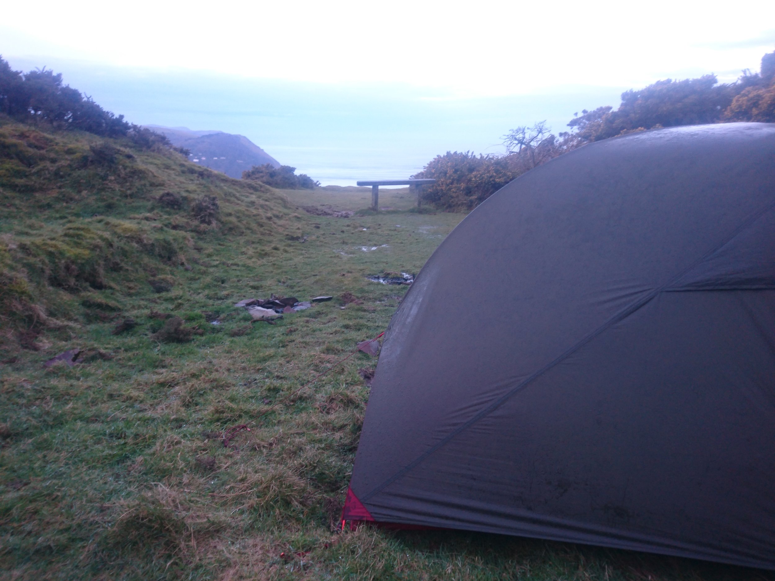
What a brutal night, it appeared the rain never stopped, constantly tipping down and even though I was in a little quarry, which due to wind direction should have been completely protected from the wind, the tent was still taking a bit of a battering. I was warm and dry inside and the tent was more than up to the job, but I did wake up a lot of times and reach for the head torch just to check that all pegs were in and that my rucksack was still covered. This was the most brutal night I had felt in the tent, which is strange considering I have slept in it through several named storms including Eleanor.
It was still raining heavily in the morning when I was beginning to consider packing up/going and then suddenly at 6:45 it went quiet and the rain stopped for about half an hour allowing me to decamp in the dry. A few items had a bit of inherent dampness in them but nothing too bad.
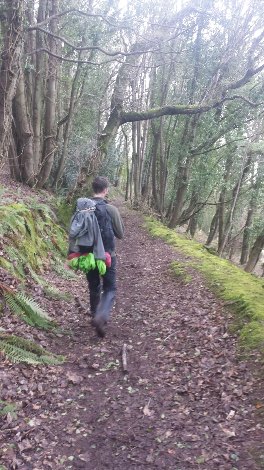
When going to sleep last night I had suddenly realised I was in Exmoor so there was a chance that I may be joined by ponies. Fortunately, they didn’t disturb me in the night but as I set of on the walk it became apparent how close they were with a small group less than a 100m from where I was pitched. The path followed the cliff gently undulating, entering several different types of woodland firstly Gurney Wood which had a feeling of ancient woodland with old native trees (obviously without leaves at this time of year) and it was lovely to amble through. I encountered two groups of deer in this woodland, one numbering seven, and once seeing me they just slowly sleeked back into the depths of the woodland.
After heading through a gate, the woodland began to change as rhododendrons began to have taken over. However beautiful these may be when in flower they are invasive and completely take over in the end. Here they had completely taken over with the whole woodland in fact being rhododendrons, having killed everything else off, some of these were several stories high. After a long distance of this total cover there was an area where they had tried to begin clearing it, they had cut large swathes and left the cut pieces on the ground. The issue being they hadn’t burnt or treated the ground, so new shoots were already flying up. If the national park doesn’t begin to get this under control it will take over the entire park in the not too distant future. This was by far the worst case of rhododendron spread I had ever seen.
The path continued gripping the cliff and still not climbing or falling too steeply though it did encounter a few fast-flowing streams which were absolute torrents due to the recent rain and had no bridges to cross them. These were not easy to cross, with slippery rocks and water deeper than the height of my boots in most parts but I just about managed to cross the 3 or 4 of these without getting water in my boots. Whoever placed the signage here must have been a bit drunk with one sign encountered saying Culbone 4 miles, then half a mile later another saying 4.5 miles, then couple hundred meters later 3.5 miles, then a good distance later 4 miles again. I would hazard a guess there was a mile and a half between the first 4-mile sign and the last.
I was really enjoying all this woodland walking which was also protecting me from the worst of the wind and rain, and the final type of woodland was fir which smelt amazing after the recent rainfall and it was not long till I was at Culbone hamlet with it’s incredibly small and quaint church. This is the smallest complete parish church in the country, and has a rich history dating back almost a 1000 years, including lepers and sat in this steep tree lined valley with only two other buildings was very picturesque.
From here the path climbed up and over to Porlock Weir, which appeared to have as many pubs, restaurant, hotels as houses, showing that this is probably very popular with tourists in Summer. I took a short diversion inland to Porlock to meet my friend Sarg who was joining the walk for the day. I was a little apprehensive as anyone who knows Sarg knows about his time keeping, having at one stage missed an entire wedding and several times turned up to events more than 3 hours late. But based on his messages he was to be arriving at 1:22, so a bit before 1 I arrived in Porlock and waited inside the Royal Oak. This was an interesting place and my favourite moment was the chef screaming out to the barman that he was running out of chips so could he go and get some chips from the shop, the barman returned and all I heard from the kitchen was ‘I said chips, not f*$#ing potatoes, I don’t f*#£ing make the chips.’ And then just after 1:22 to my slight surprise Sarg wandered in and it was great to see him. He told me about the bus from Minehead to Porlock which arrived and was just a glorified van and he hadn’t relaised it was the bus, but fortunately the driver started waving at him and then he realised it was the bus and waited by the door and then had to be signalled by the driver that he had to open it himself. I think Sarg was now getting used to the quirks of the South West having left London in the morning.
As for all my guests (bar one) though I had been battered by rain for the previous 24 hours, the weather suddenly turned nice and the sun even came out. We headed back down to the coast path, and through the very quaint National Trust village of Bossington, where Sarg was intrigued by the thatched cottages, before beginning the final big climb of the day up Bossington Hill. At the top, the path plateaued out and though there were 2 SWCP routes shown on my map here, one right on the cliff and one a few hundred meters inland, the only one signposted from this end seemed to be the slightly inland one so we took this. I am not sure if this was a diversion of if the other one was just not as well signposted. Either way our path gently undulated for the next few kilometres along the top of the hills, surprisingly having to climb over some of the snowdrifts that still remained from a week ago.
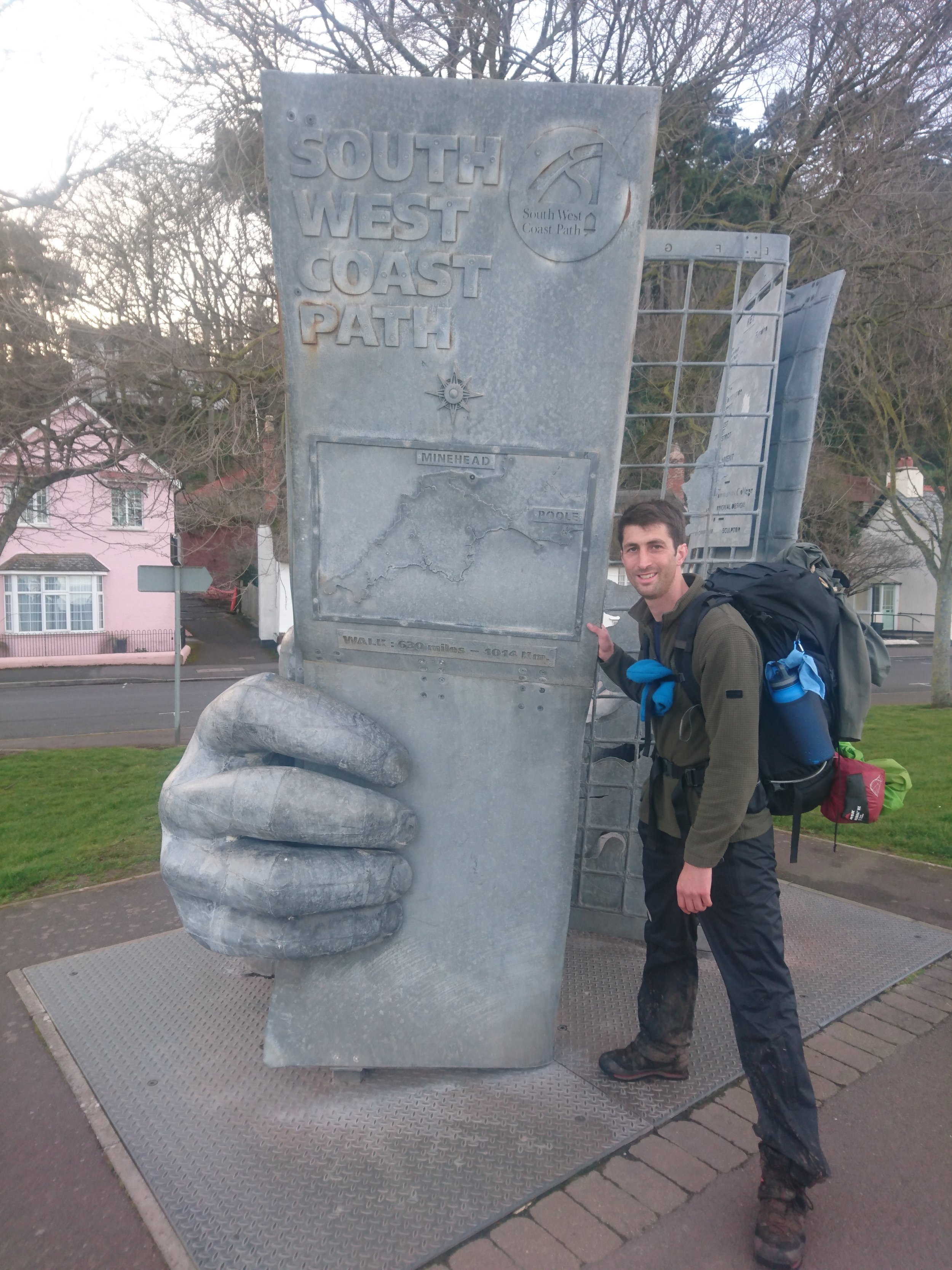
The path re-joined the cliff and steeply descended down to the shore at Greenaleigh Point, and we were very soon in Minehead. This bought to an end the South West Coast Path part of the trip, and the apparently 630 mile stretch had actually taken nearer 700 miles with the many path diversions and short inland stretches to shops. This has been a great 34 days of walking and though it has thrown everything at me (wind, rain, snow, ice, sun, mud, collapsing steps, psychotic sheep, multiple diversions to name a few) it has been quite simply spectacular. My knees are definitely happy though to have seen the back of it.
Sarg had kindly booked an Airbnb flat for the two of us in Minehead. After a giant pizza and a pint we returned to the flat and I was so incredibly sleepy I got none of my admin or diary done.
A great day, both walking and having Sarg join me, and a very significant one. The next milestone will be entering Wales and the beginning of the next chapter the Welsh Coast Path.