Day 141: Carsethorn to Palnackie
Distance: 25.70 miles
Ascent: 2638 feet
Weather: Overcast Early, Sunny Rest of Day
Accommodation: WIld Camp Near Palnackie
After a nice rest day, I was off on my way earlyish about 7:15. The start of the day followed a core path (now that I know where to find them online I will include them when useful) along the beach. It was overcast and windy and the going under foot wasn’t always easy with some rocky sections, but it still felt like a good start to the day.
Strangely there was a building on the OS map called ‘The House on the Shore’ which when I got to it was a very impressive house just of the beach as was expected from the name. Eventually the path became a lot easier with a mixture of sand and sea shells making an easy walking surface. Slightly worryingly there was a lot of oil on the beach around Gillfoot Bay, stretching along the high tide zone. I have seen small patches on the walk before but nothing like this and I wonder if they will try and actively clean it.
On reaching Southerness Point I came across the interesting Lighthouse that is square in shape of the masonry structure but topped with a half circular glazed area for the light. From here I followed the foreshore and sandflats all the way to the Mersehead Nature Reserve, where I had to head inland a little to cross Southwick Water. The little RSPB visitor centre was just opening so I stopped for a quick tea and a piece of flapjack.
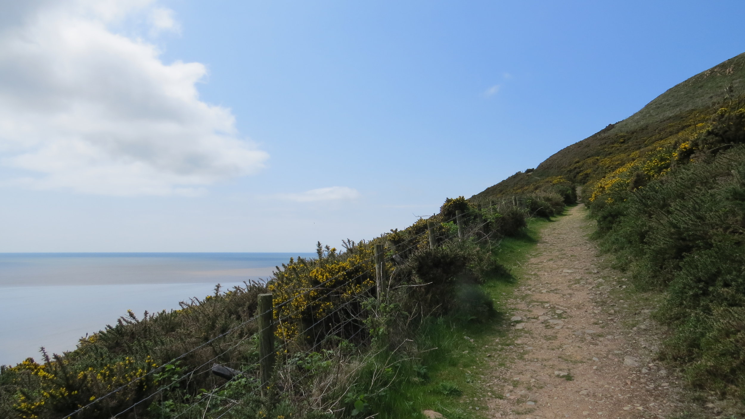
At Caulkerbush I crossed the river and unfortunately had to follow a quite busy and fast road for 2.5 miles to Sandyhills. But from this point, quite to my surprise, the paths and scenery completely changed. In fact, it became completely stunning and the sun was now fully out. There were some quite steep climbs, which were my first in many weeks, but this meant the views were even better in all directions whether over the massive expanse of sands with the Lake District in the distance, or the green and lush, gauze covered hills inland. I completely enjoyed every moment of this path all the way to Rockcliffe which itself was a lovely village before following another path to Kippford. I stopped here for a bite to eat.
After this I had two options when I reached the A710, I could have walked along the A710 but this would not have been pleasant with fast cars though infrequent flying by. So instead I headed slightly further inland and through Dalbeattie Forest. Walking the tracks through this forest was lovely, and there was even one very chilled deer who didn’t seem to care that I was walking passed.
Today’s walk to this point was definitely in my top ten maybe even vying for the top spot, but I knew the last 3 miles were not going to be nice with my only option to follow the A711. As with a lot of roads around here there may have only been a car every couple of minutes but the road was narrow and the cars were fast so I just had to be careful and ensure I was always on the best side of the road. This hour or so on the road was a horrible end to the day but I finally reached Palnackie.
Palnackie has a strange claim to fame being the location of the World Flounder Tramping Championships. Flounder tramping is where you feel with your feet for flat fish in the mud and then try and trap them with your feet. This apparently used to be quite a common way of catching flat fish back in the day.
Based on a suggestion in the local pub I am pitched up in a local viewpoint which is absolutely perfect, if slightly exposed, as it is flat with short mowed grass and with a lovely view.
So apart from the last 3 miles an absolutely stunning day, with great paths, great weather and a great pitch location.