Day 182: Kentallen to Fort William
Distance: 20.09 miles
Ascent: 3087 feet
Weather: Sunny, Very Hot
Accommodation: Calluna Hostel, Fort William
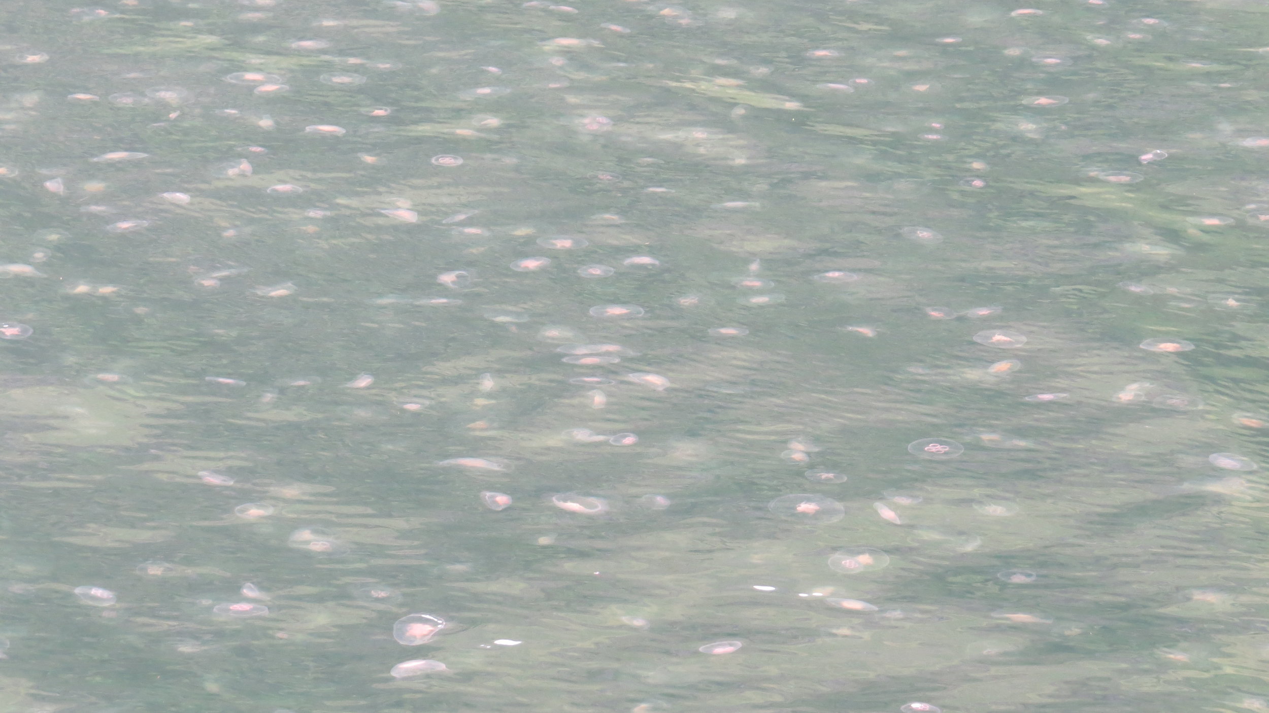
The sun was out again, and I got up and on my way nice and early. There was a faint breeze at this point which took the edge of the heat. The private road took me to Kentallen Bay where there were so many jellyfish the whole bay was covered in them, hopefully no dog jumps in without realising.
Where the private road meets the busy A828 I was certain there was a cycle path, though nothing at road level and about 50m up the slope it looked like there may be a flat area and after scrambling up indeed there was the asphalted cycle way. This first part was more like a footpath than a standard cycleway as it climbed up and over a little ridge in the middle of farming land before descending back down to the road level and taking me the couple of miles to Ballacullish Bridge.
I had known I would run out of water this morning after cooking last night and having a fair distance from top up yesterday, but I was not worried and at Onich service station I grabbed some fluid though didn’t get my water filled up here as felt like I may get a no in a service station so decided to wait to do that in the actual village of Onich.
The cycleway, now not so great, became at times a thin pavement but carried onto Onich. I knew the cycleway joined the busy road after passing the Corran Ferry, which was unwalkable so I had plotted a route using forest tracks which I believed would only have a kilometer or so of off piste, but this would be through woodland which can be hit and miss either really easy through the trunks or if dense lower growth can be impassable. I stopped at the chalet park in Inchree and filled up my water and the lady in reception when I asked about the route suggested an alternative that used a different forest track and had a mile of off piste before joining the road, but she had done the of piste part herself with a mountain bike so said it was easily passable. She said head to the end of the track, then there was a sort of stile over the fence and from there you could actually see the farm where the road on the other side started from.
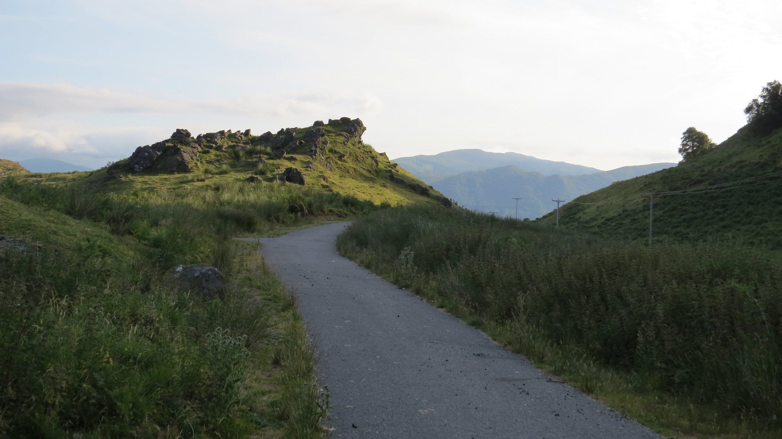
I decided to take the ladies route, the only slight issue being it was just off the side of my map and my phone signal was almost non-existent. The breeze had dropped completely so we were back into desert inferno conditions. So, from Inchree car park I took the track I believed to be correct heading roughly easterly to start with. This track headed steeply up and was obviously well used by forestry vehicles though I only saw two vehicles one of which covered me in dust. I began to get quite anxious about whether I was on the right track, I kept thinking I am going too far east, I should be seeing the end of the track by now, but the other side of my brain was saying there was no other track and the ridge is not far to your left. In fact these anxieties grew and grew and after an hour of walking along it I very almost turned around, I am not sure what stopped me as I became almost convinced I was on the wrong track. But I decided to continue to the little loch which I could see on google maps as I remembered there was some water near the farm. One small part of this map was still viewable, not overly helpful as was all green or white with no tracks or roads shown even though I had no signal, but the GPS arrow was still active, and I could tell I was now vaguely heading to the loch. I finally reached a U-bend in the road which I took to be the end of my track, and there in front of me was a sort of stile. But I could not see any farm from here, but the small electricity poles continued, and I could only assume to a farm. So, I strode out across the plateau made up of grassy but also boggy in places ground, and after 500 or so meters suddenly I could see the edge of the loch and then the roof of the farm. I was so unbelievably relieved and finally I reached the farm. I have failed to mention how jaw droppingly scenic the mountains (and yes I think mountain is fair description of these ones) are around this plateau.
I knocked on the farm door to get some water and then sat under a tree and had a break. I knew the small road would take me all the way to Fort William but as it was not my plotted route I didn’t no how far. I had assumed about an hours walking. Soon after leaving the farm I skirted the very edge of the West Highland Way though never actually joined it as my little road was more coastal. This is a 96 mile walk from near Glasgow all the way to Fort William, and I had been told it was one of the most popular long-distance trails in Scotland. Indeed, even in the five minutes I could see the route I saw 3 groups heading north and one group heading south and that is more walkers than I have seen in weeks! A little further down the road I came across a group of Duke of Edinburgh walkers who were all huddled around a map clearly not having a clue where they were and I heard one say ‘But we are not allowed to ask for help’ but another guy wasn’t so worried and just asked. Fortunately they were on their route they just thought they had gone further than they had so had another half a mile till their turnoff. My guess for the road length was wrong but after almost 2 hours I made it to Fort William.
Yippee I had made it to my rest day and I had booked into a hostel where I would be for my two nights. I am really going to try and do as much admin as possible as with guests joining and probably poor signal I will struggle with it over the next couple of weeks.
A good, incredibly scenic day, though I did not like not having a map for that section!
NB-Before anyone else says it I know it is silly heading off on a route not covered by a map but the worst that could happen would have been I had to walk all the way back down the track, which admittedly would have been terrible.