Day 244: Crosskirk to Brough
Distance: 25.89 miles
Ascent: 2516 feet
Weather: SUnny Spells But Windy
Accommodation: Windhaven Cafe, B&B & Campsite (kindly Complimentary)
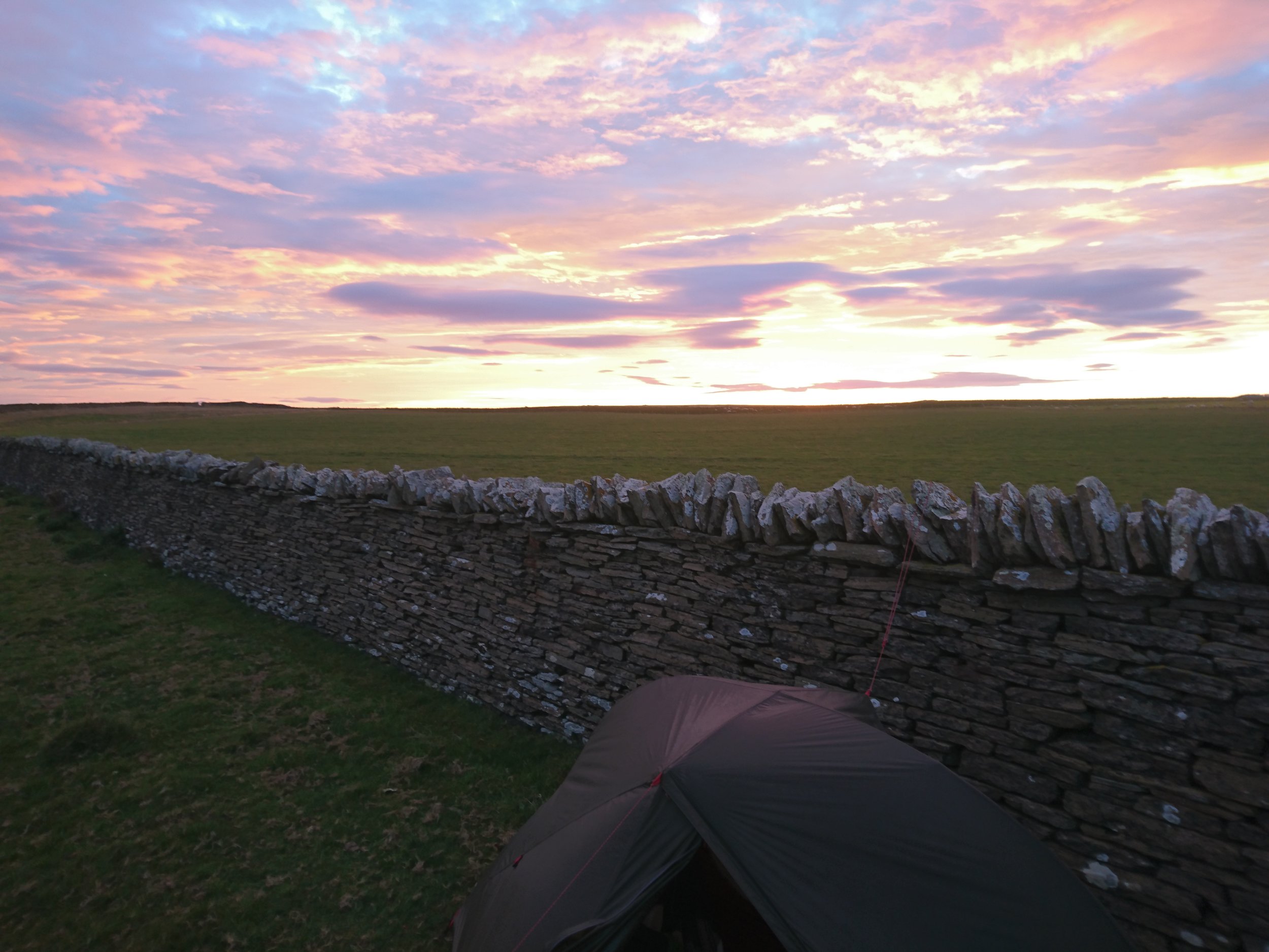
I woke up early and packed up quickly and was ready for the off a little before 7. The seasons have definitely started to change over the last week, with the temperature dropping and now the tent (as per earlier in the year) outer being wet in the morning even if it hasn’t rained due to condensation. But what a beautiful morning and a stunning sky with streaks of pink and purple on the horizon contrasting to the blue above. There were also the biggest waves I have seen in the UK, 20+ foot but completely unsurfable (to my eye anyway) as they rose up close to the rocks and only broke directly on the rocks.
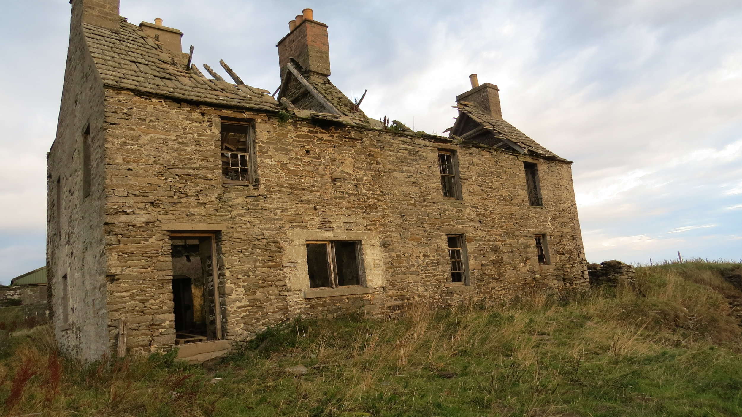
From the tent I literally headed straight along the sheep track 5m away and then followed the low cliffs directly. I had been told a bit of the route had slipped into the sea outside Mains of Brim farm so one field before I went through a gate and then directly for the farm sheds which I could walk through and cut of any issue there might be. Straight after the farm sheds I was back on the coast passing a ruin of a lovely old building and the bay after had about 30 seals all floating with there noses in the air.
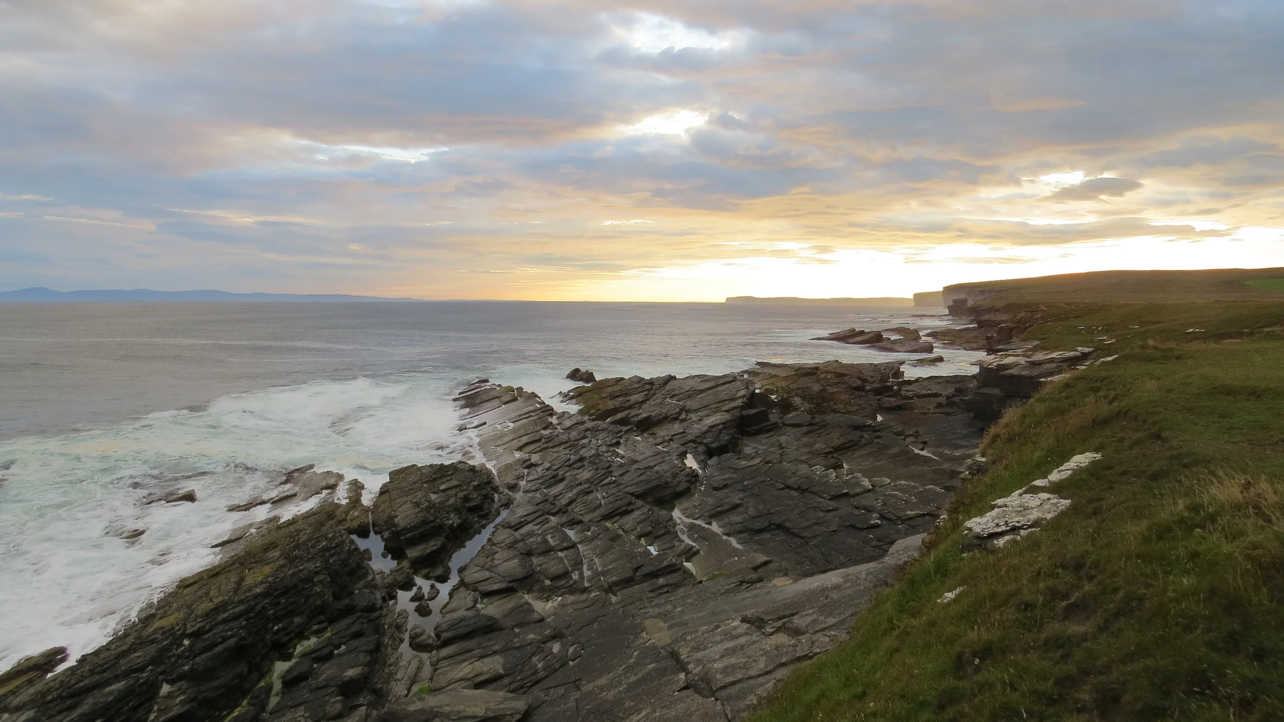
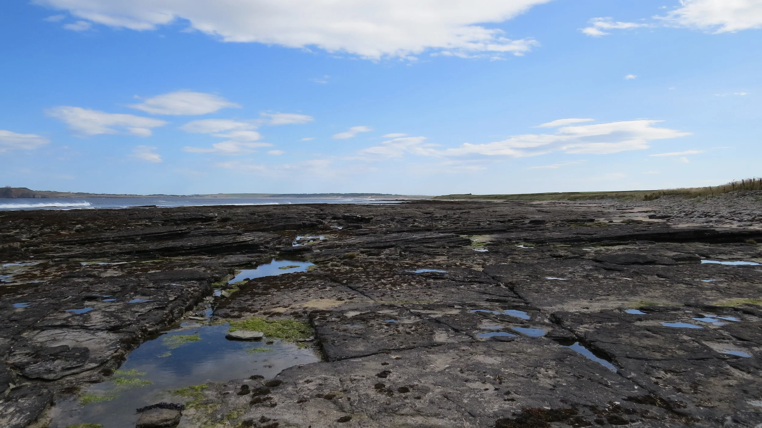
It was a perfect morning, perfect weather and beautiful views along the cliffs and slowly the flat section started to climb up and onto the higher cliffs before passing some disused quarries. These were intriguing quarries right on the edge of the cliffs with only a meter or so section of cliff left in places to protect the quarry a little from the elements. The ground was a perfectly flat strata of slate that they had excavated too and I am glad it was dry because I bet this is super slippy in wet conditions.
From here after rounding Holborn Head, I soon approached Scrabster on the outskirts of Thurso. There was a bizarrely located lighthouse here that from most directions you couldn’t see the light, and a quite large industrial port. I had to run into a hotel in Thurso due to bodily needs and then stocked up on some supplies and stuff for breakfast.
Replenished I crossed the pedestrian bridge and headed out of Thurso on a path along the coast, passing a ruin of a lovely old mansion (apparently behind the ruin there is still a beautiful used mansion.) At Thurso East I was informed by an elderly gentlemen that this was the best surf spot in Europe, and though this was almost definitely an exaggeration, today it was pumping. I would hazard a guess at waves a bit over 12 foot and though I don’t surf the waves looked perfect with incredible barrels but the only slightly scary thing was that the waves broke not long before the rocks so the surfers had to steer right quite sharply or bail early if there were issues. I actually watched for about 15 minutes and took a few photos though the best photo I got (below) is of a slightly smaller wave.
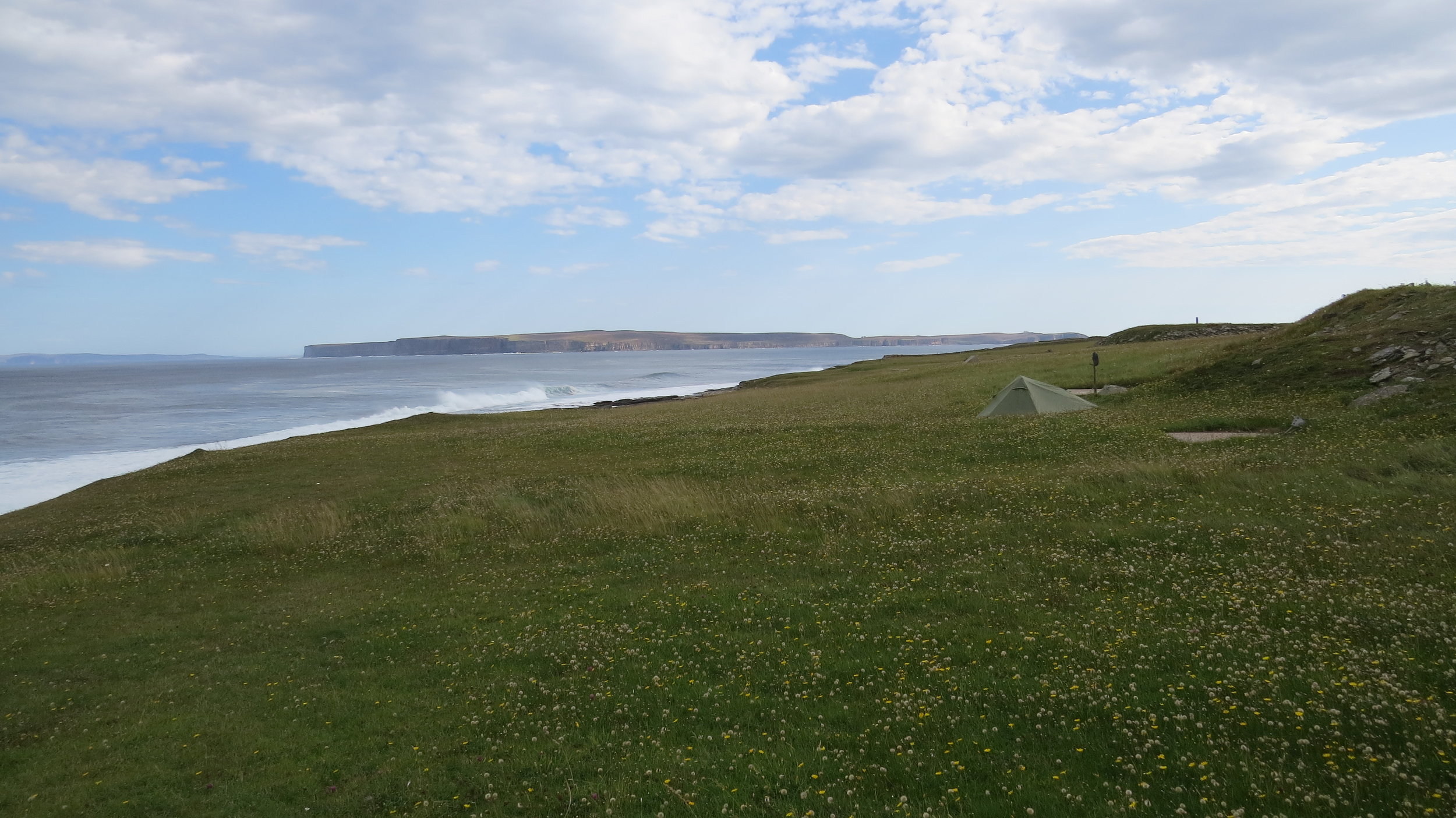
I was once again following the edge of the low cliffs for a few miles and I passed a wild camper in a lovely spot, before at Murkle Bay I dropped down to the foreshore. I walked along the flat rocks and there was one narrow strip that took me around a little headland and onto the sandy Muckle Bay beach. I then rejoined the flat rocks for a mile or so before joining a track just west of Castletown.
I joined Ian here again and together we walked the sandy beach out of the town which is a perfect arc of sand covering about 2 miles. Well would have been perfect if it wasn’t for wind which was creating a mini sand storm along the beach which fortunately was hitting our backs and not into our faces.
At the end of the beach there was a little inland diversion on road before rejoining the coast at Dwarwick Pier. This is where the Queen and Duke of Edinburgh landed in 1955 on the Royal Yacht Britania to come to visit the late Queen’s Mother at Castle of Mey. Ian said goodbye here and I carried on.
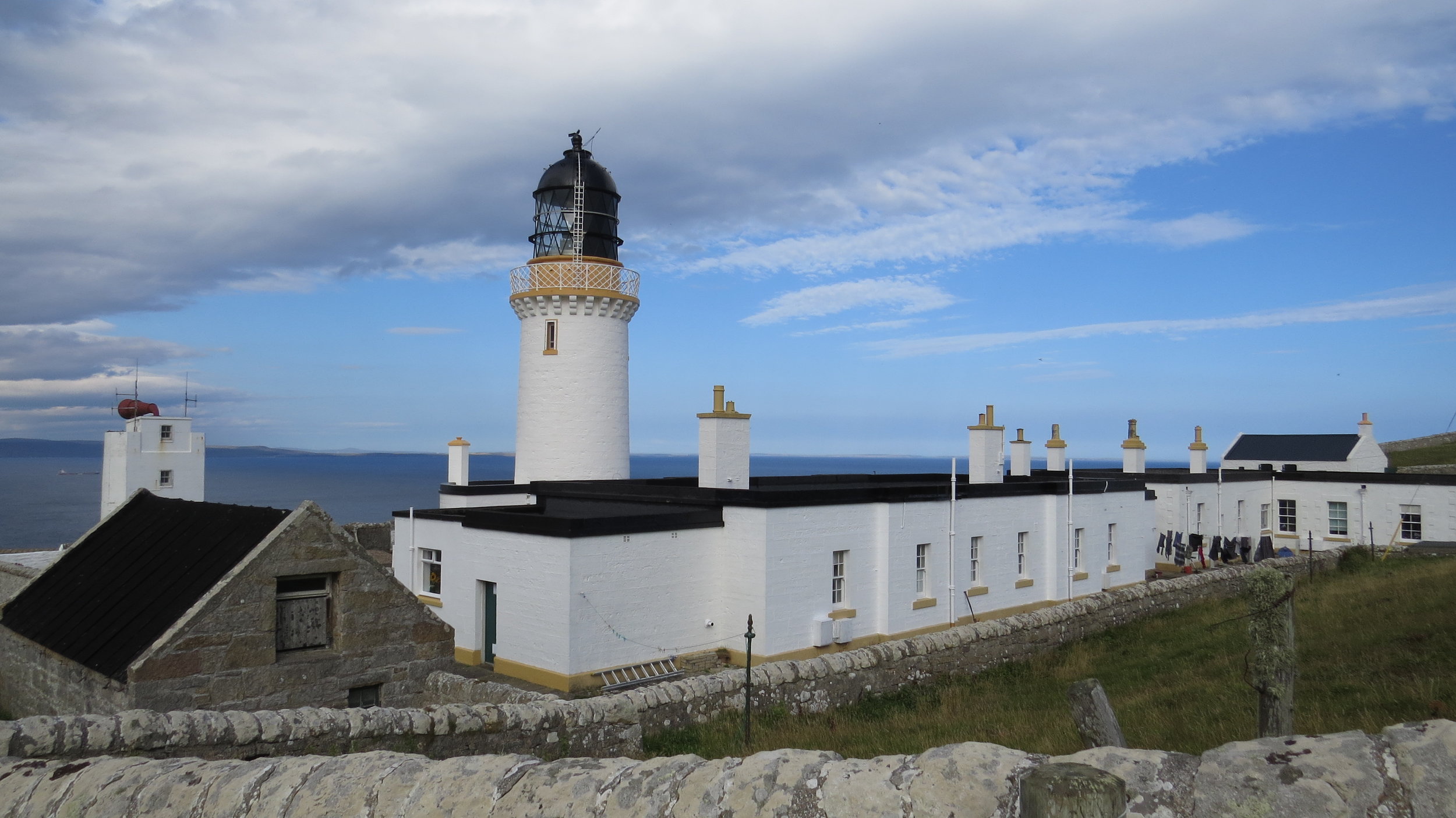
My original finish point for this week was here but due to a kind offer I now had about 3 hours of further walking around Dunnet Head. The first climb up was steep and then it was a matter of just walking near the cliff edge but not too close due to the wind (at times it blew me several meters sideways). Luckily the wind was onto the cliffs and the track (sheep & people track) in most places was a sensible distance from the cliff. This section was stunning with the high vantage point giving incredible views back from where I had come over the previous week. I passed one main loch and eventually Dunnet Head lighthouse came into view and I followed the sheep track all the way to the viewing spot and in fact the most Northerly Point of mainland Britain. So, 3 cardinal points ticked off only 1 more to go.
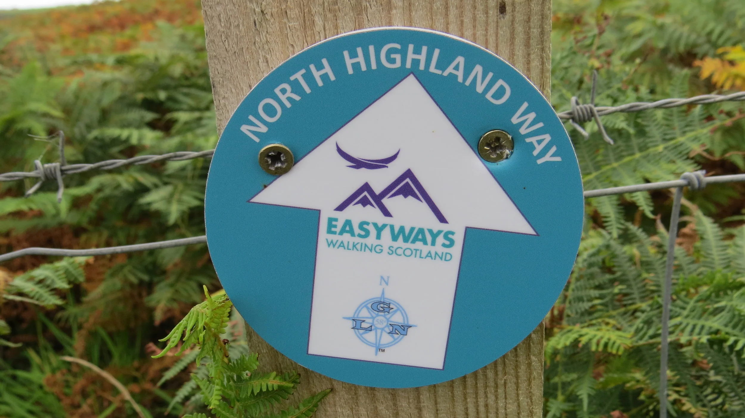
After scaling the higher viewpoint I dropped down to another sort of track (not as clear on this side) and followed the cliffs towards Brough. I actually saw my first North Highland Way marker here (they are soon to be placed along other parts of the route.) and the last part between a fence and the cliff was a little to close for my liking especially with the overgrown vegetation creating trip hazards so on the narrow bits I stayed as close to the fence as I could.
I bumped into Phil just as I was joining the road, who owns Windhaven where they had kindly offered to put me up for my rest day. They and their dog Sky made me feel very welcome, well the dog maybe a bit too much seemingly loving the odour of my bare feet and giving them a free wash with his tongue. I was made to feel like a king with a bath being run for me and a lovely roast chicken dinner being cooked. I am very grateful for their kindness and think this will be a great location for a rest day.
Today bought to the end a run of 3 quite long days, and together made it a tough stretch and I am now ready to chill.